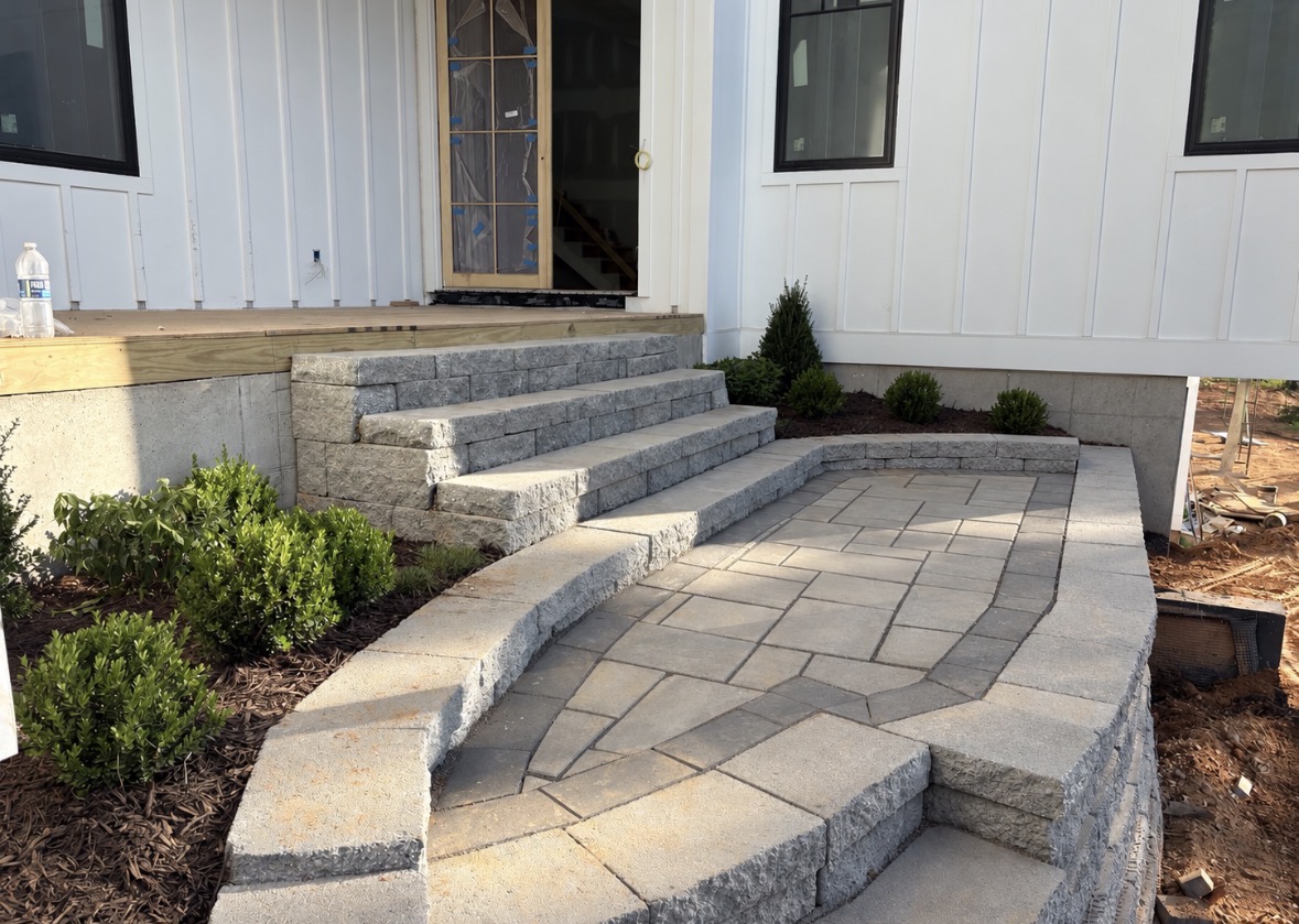
Near the Terrell Historic District, we design terraces, paver areas, planting beds and paths for yards that descend toward Lake Norman. Drainage is resolved before level space is shaped, and the free on-site estimate has no trip fee.
There is no office counter in Terrell; our crew meets homeowners where the grade and outdoor space can be reviewed together. NC 150 and Sherrills Ford Road are familiar from weekly service throughout these towns, and scheduled visits occur when promised.
Terrell Historic District is located at The crossroads of NC 150 and Sherrills Ford Road, Terrell, NC 28682.
The Terrell Historic District was listed on the National Register of Historic Places in 1986. It covers about 150 acres and roughly 15 major historic buildings.
Buildings include the Coleman-Caldwell-Gabriel House from 1854, Rehobeth Methodist Church from 1889, and a country store and post office from the 1880s and 1890s. The district retains a rural setting with newer lakeside development nearby.
Lake-facing slopes can use retaining walls and terraced hardscaping to create level space, but drainage is planned first. Lighting can then support paths and steps that move down the grade toward the water.
A lake-facing slope limits usable ground until walls or stepped hardscape establish stable levels. The landscape plan starts with drainage between those elevations so a patio, bed or lawn section does not obstruct runoff moving down the property.
Paths and steps toward the water need a clear sequence through each terrace, with lighting considered at the same time as the route. Planting areas then fit beside those transitions without narrowing access or placing loose material where the grade carries rain.
Creates planned terraces on a Terrell slope after the grade and water route are established.
Builds a level gathering area and connected steps within the changes in elevation toward the lake.
Shapes the transitions between terraces while preserving controlled surface drainage through the yard.
Coordinates walls, paths, beds and usable areas from the house down the lakeside property.
Places vegetation where roots, mature growth and maintenance access fit between structural features.
Contains soil and mulch on a selected level instead of exposing loose material to the full slope.
Terrell is unincorporated. Catawba County Utilities & Engineering has an Erosion Control and Stormwater division. Work close to the Lake Norman shoreline may require approval from the lake’s managing authority, Catawba County, or both.
The district is centered at NC 150 and Sherrills Ford Road. Use the embedded map for the area.
We lay out retaining features and drainage together, then establish level sections for the intended patio, lawn or planting use.
We connect the necessary elevation changes with steps or walkways and leave practical access beside walls and beds.
We identify the proposed work area and flag questions for the lake's managing authority or Catawba County before that scope proceeds.
Call 704-460-2019 or send the contact form. There is no trip fee.