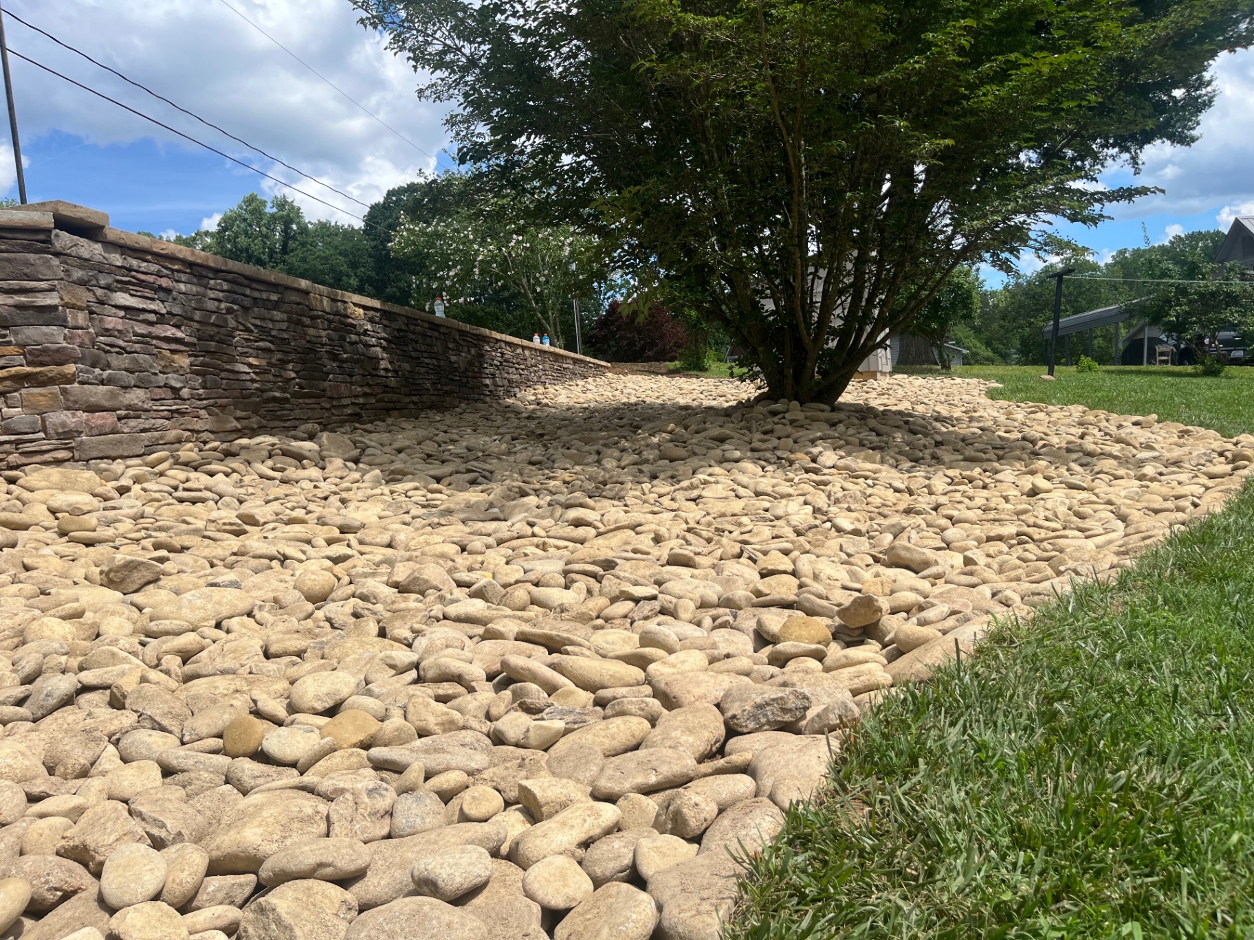
Terrell roofs, driveways and upper yards can send combined runoff down Lake Norman-facing slopes toward patios and beds. We plan that downhill route before lower hardscape is placed, beginning with a free on-site estimate and no trip fee.
Our company keeps no Terrell storefront because the crew needs to see the slope at each property. We travel NC 150 and Sherrills Ford Road during weekly work across the communities served, and we appear at the appointment time agreed with the homeowner.
Terrell Historic District is at The crossroads of NC 150 and Sherrills Ford Road, Terrell, NC 28682.
The Terrell Historic District was listed on the National Register of Historic Places in 1986. It covers about 150 acres and roughly 15 major historic buildings.
Buildings include the Coleman-Caldwell-Gabriel House from 1854, Rehobeth Methodist Church from 1889, and a country store and post office from the 1880s and 1890s. The district retains a rural setting with newer lakeside development nearby.
Terrell is on Lake Norman’s western shore, where many lots slope toward the lake. Roof, driveway and upper-yard runoff can travel downhill toward patios, planting beds and the shoreline.
Terrell properties on Lake Norman's western shore can fall from the house toward the water, giving separate roof and driveway flows room to combine. The inspection identifies where that concentration occurs and whether an upper diversion is needed before runoff reaches a lower patio or wall.
Terrell remains rural around its historic crossroads while newer lakeside development sits nearby, so neighboring parcels may have very different grading. We base a proposed swale or pipe on the individual lot and keep shoreline questions separate from private drainage work.
Carries roof flow beyond the upper yard instead of releasing it above a lakeside patio or planting area.
Guides surface runoff around a house before it accelerates down the Terrell slope.
Intercepts water moving through soil above a lower terrace when surface grading alone does not address the source.
Evaluates a flat bench in the hillside where downhill flow pauses and collects after rain.
Creates an aggregate-and-pipe path behind a wall that forms level space on the grade.
Places a surface collection point where the lot provides both a defined low area and usable fall.
Terrell is unincorporated. Catawba County Utilities & Engineering has an Erosion Control and Stormwater division. Work close to the Lake Norman shoreline may require approval from the lake’s managing authority, Catawba County, or both.
The district is centered at NC 150 and Sherrills Ford Road. Use the embedded map for the area.
We trace roof, driveway and yard water separately from the upper property before deciding where they may be collected or redirected.
We do not assume the shoreline is an available outlet; the proposed endpoint is reviewed against the property and applicable approvals.
We include it when a retaining structure interrupts the slope and needs a route for water gathering in the soil behind it.
Call 704-460-2019 or send the contact form. There is no trip fee.